
[THE PORTFOLIO OF BRYANT KORZENIEWSKI]
[Updated 07/05/2005]
[CONTENTS: WORK FROM 2004 TO PRESENT]
The work presented on this page represents work using ArcGIS8 and results from taking courses through North Carolina State University's Distance Education Program and ESRI's Virtual Campus. Procedure Logs detail work via ArcGIS 8 on the corresponding assignment/project and was a requirement of the PRT462 course.
To ensure optimal viewing and to conserve use of Tripod's bandwidth, right click on each file link and choose "Save Target as".
Note: Please be sure that your favorite virus scanning software (i.e. McAfee, Norton, etc.) is up-to-date, as well.
[PRT462: Introduction to Geographical Information Systems (3 Credit Hours)
North Carolina State University via Distance Education (a.k.a. D.E.L.T.A.).
Using principles of ESRI Courses Learning ArcGIS 8 Part I and Learning ArcGIS 8 Part II]
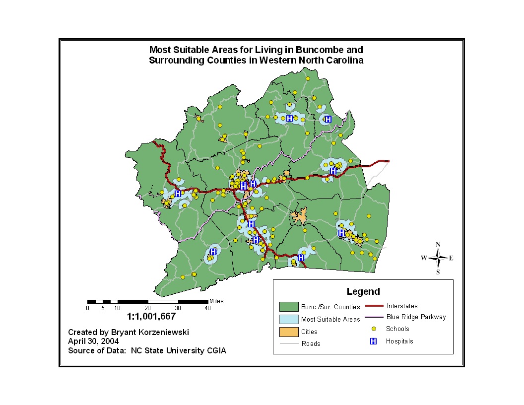
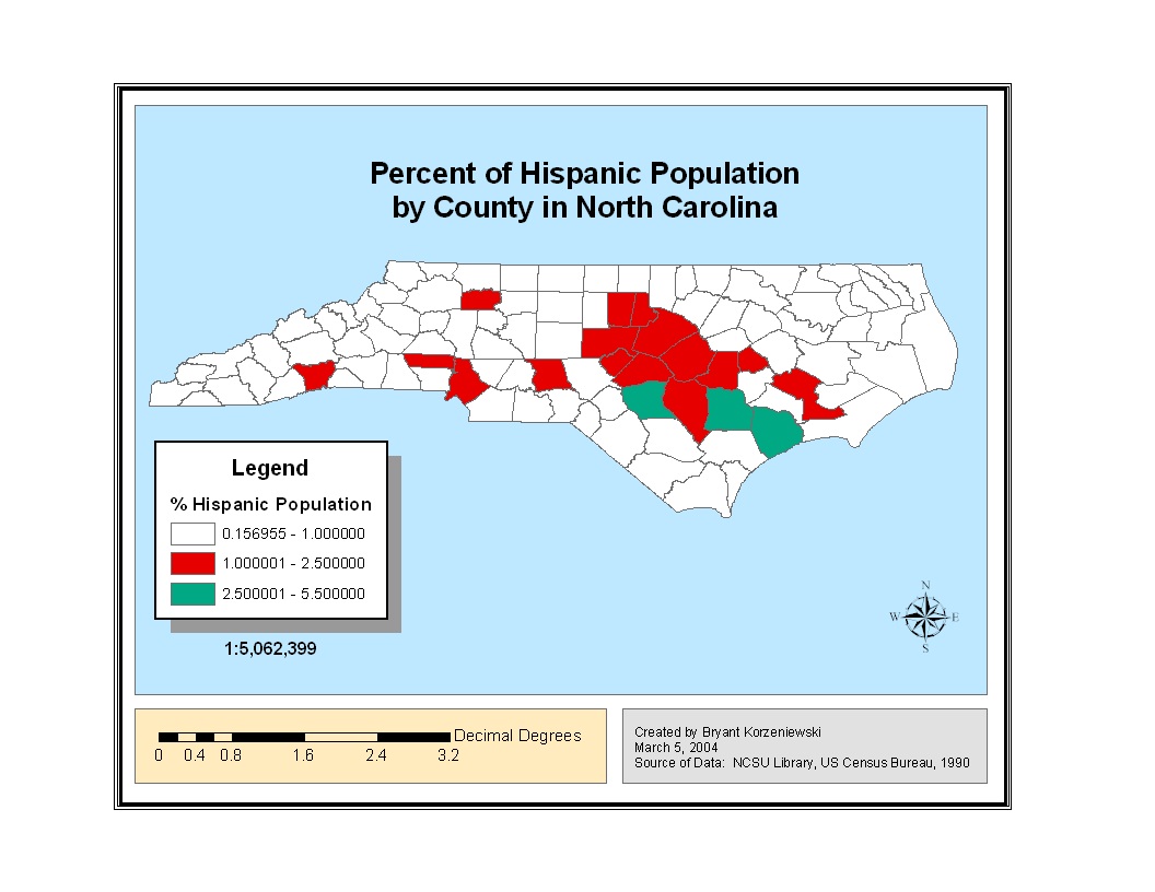
[PRT462 Final Project (April 2004)]
[PRT462 Final Project Procedure Log (April 2004)]
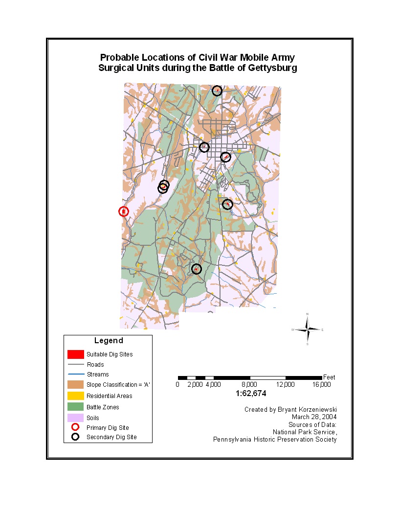
[PRT462 Mini Project (March 2004)]
[PRT462 Mini Project Procedure Log (March 2004)]
[PRT462 Assignment 3 (January 2004)]
[PRT462 Assignment 3 Procedure Log (January 2004)]
[PRT462 Assignment 4 (January 2004)]
[PRT462 Assignment 4 Procedure Log (January 2004)]
[PRT462 Assignment 5 (February 2004)]
[PRT462 Assignment 5 Procedure Log (February 2004)]
[PRT462 Assignment 6 (February 2004)]
[PRT462 Assignment 6 Procedure Log (February 2004)]
[PRT462 Assignment 7 (February 2004)]
[PRT462 Assignment 7 Procedure Log (February 2004)]
[PRT462 Assignment 8 (March 2004)]
[PRT462 Assignment 8 Procedure Log (March 2004)]
[NR535: Computer Cartography (2 Credit Hours)
North Carolina State University via Distance Education (a.k.a. D.E.L.T.A.)]
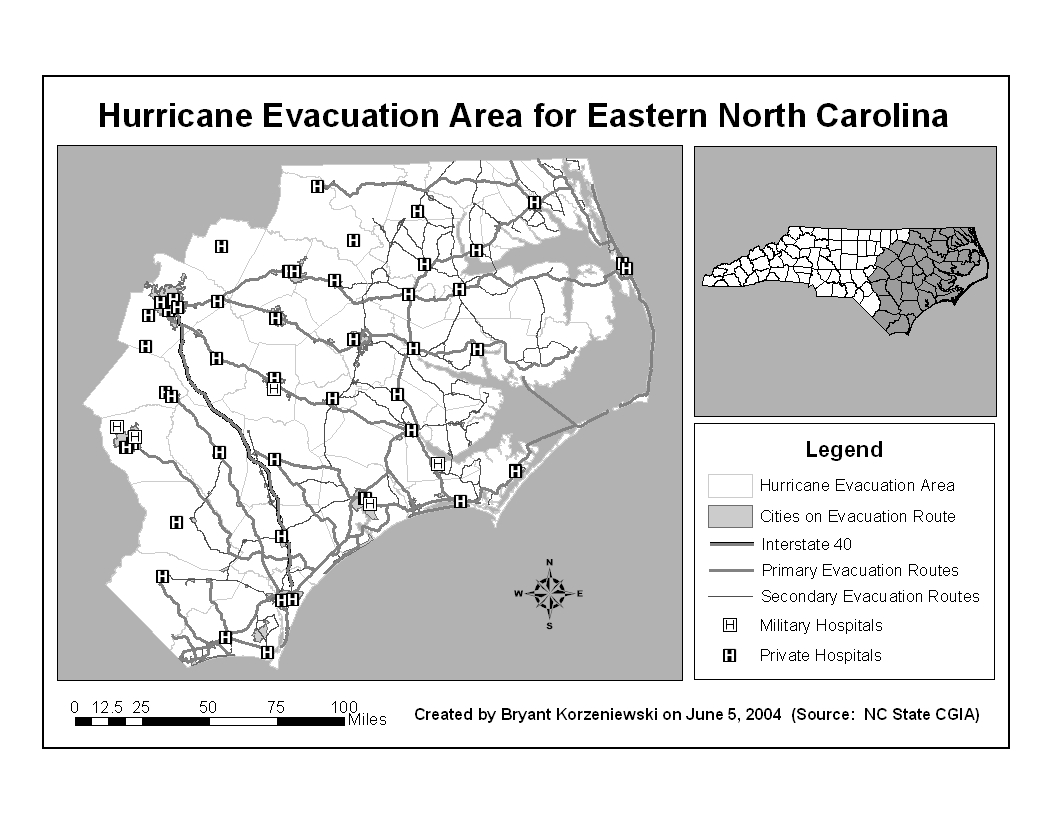
[NR535 Project1 at Full-size (June 2004)]
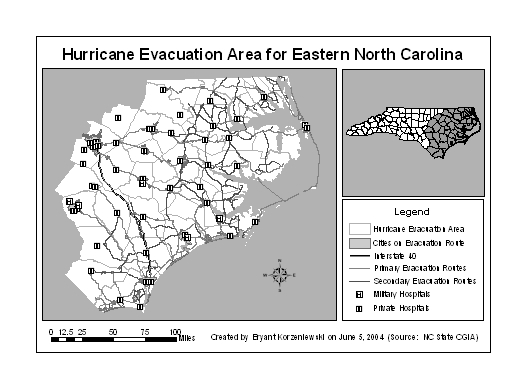
[NR535 Project1 at Half-size (June 2004)]
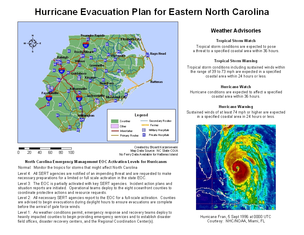
[NR535 Project2 (June 2004)]
[NR535 Project 3 (July 2004)]
[Related Projects]
[STORM WATCH 2005]
[ELSEWHERE ON THE SITE.....]
Hurricane Season is in full swing. Prepare Now!
![[STORMWATCH 2005: PREPARING FOR THE 2005 HURRICANE SEASON]](../hurbutton2005.jpg)
Don't forget to check out the latest Entertainment News!
This web page is a formally validated HTML 4.01 document.
This web page accesses a formally validated Cascade Style Sheet (a.k.a. CSS).
COPYRIGHT 2002-2005 [BEEBS' CORNER]